Satsale — Satellite Imagery Selling Platform (UI/UX Case Study)
Overview
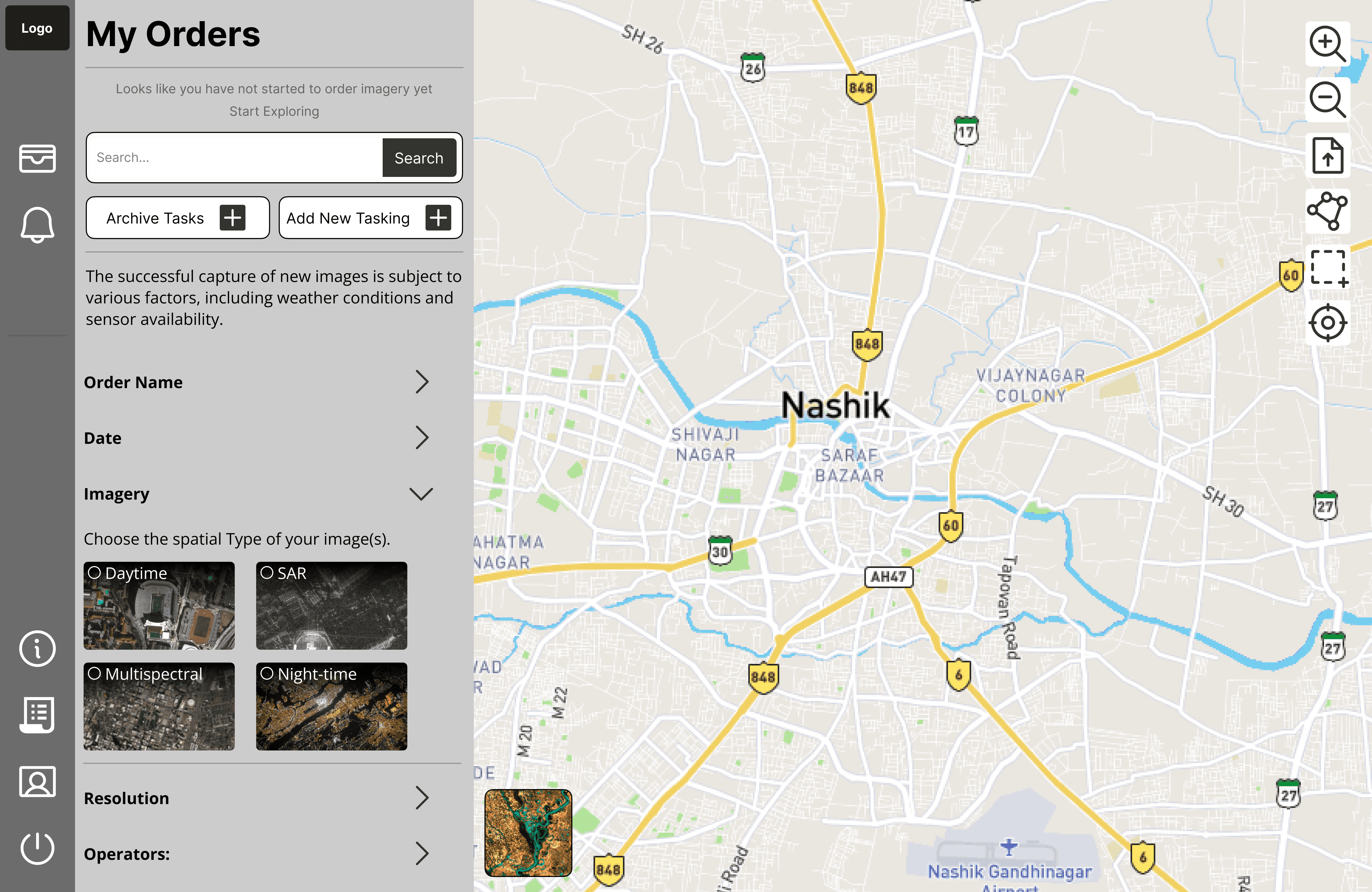
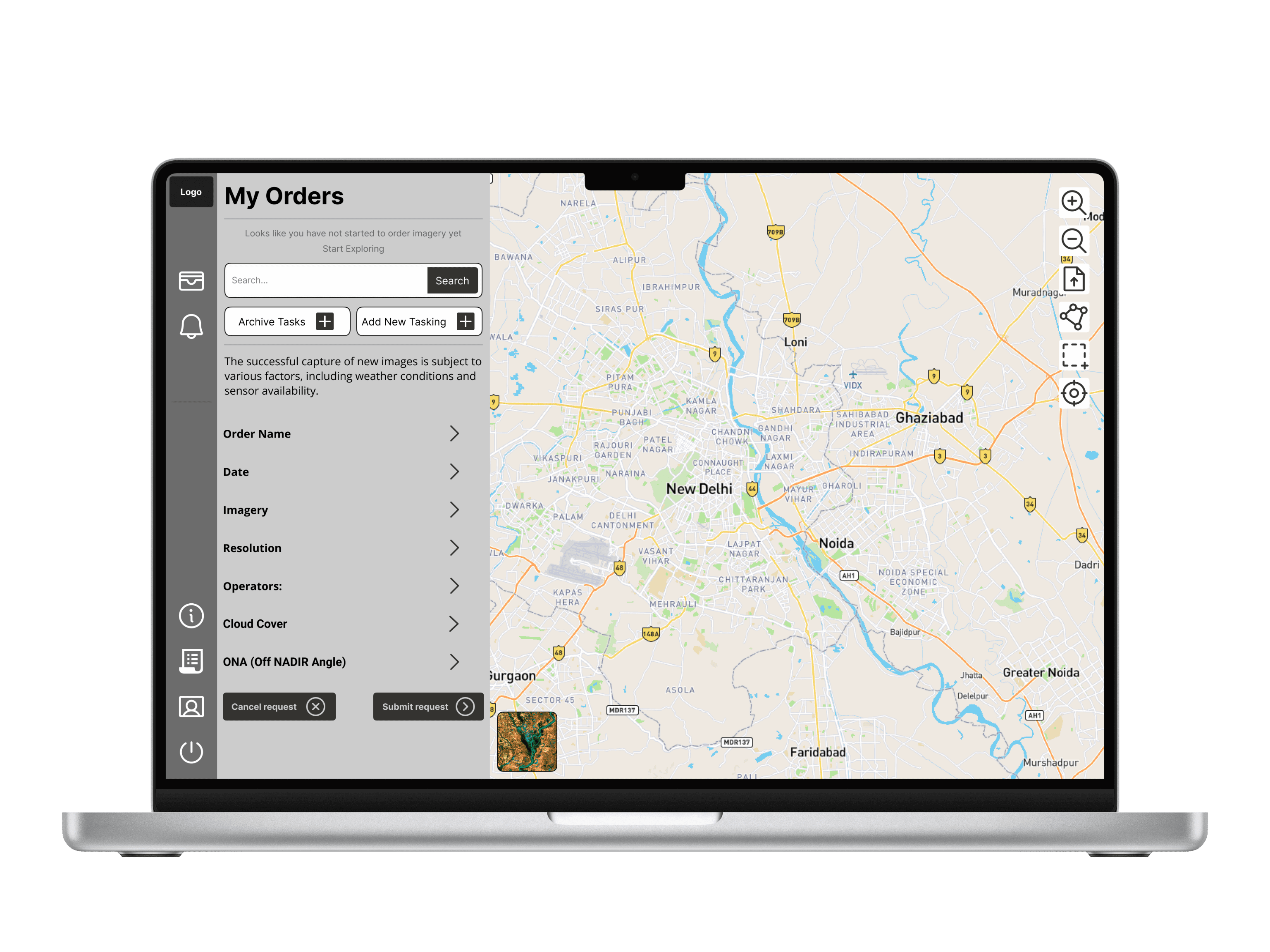
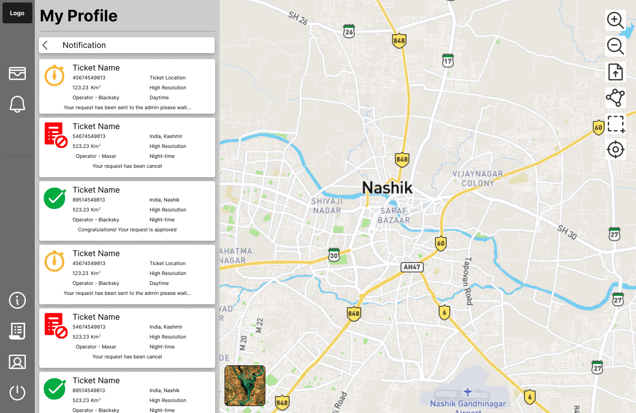
Satsale is a satellite imagery selling platform designed for both individuals and organizations to easily discover and purchase satellite data. The main challenge was to simplify a complex workflow—selecting an AOI, choosing resolution, operator, time range, and imagery type—into a clean, guided user experience. I designed a map-first interface where users can draw and save their required AOI using rectangle or polygon tools, then apply filters to refine imagery results. After submitting the request, the platform follows an admin verification process where requests are approved if imagery is available and clear, or rejected if the data cannot be provided. This design improves clarity, reduces friction, and creates a scalable system for future features like pricing, downloads, and order history.
Categories
Satellite Imagery Platform
GIS UI/UX Design
Date
Client
Satsale — Satellite Imagery Selling Platform (UI/UX Case Study)
Overview
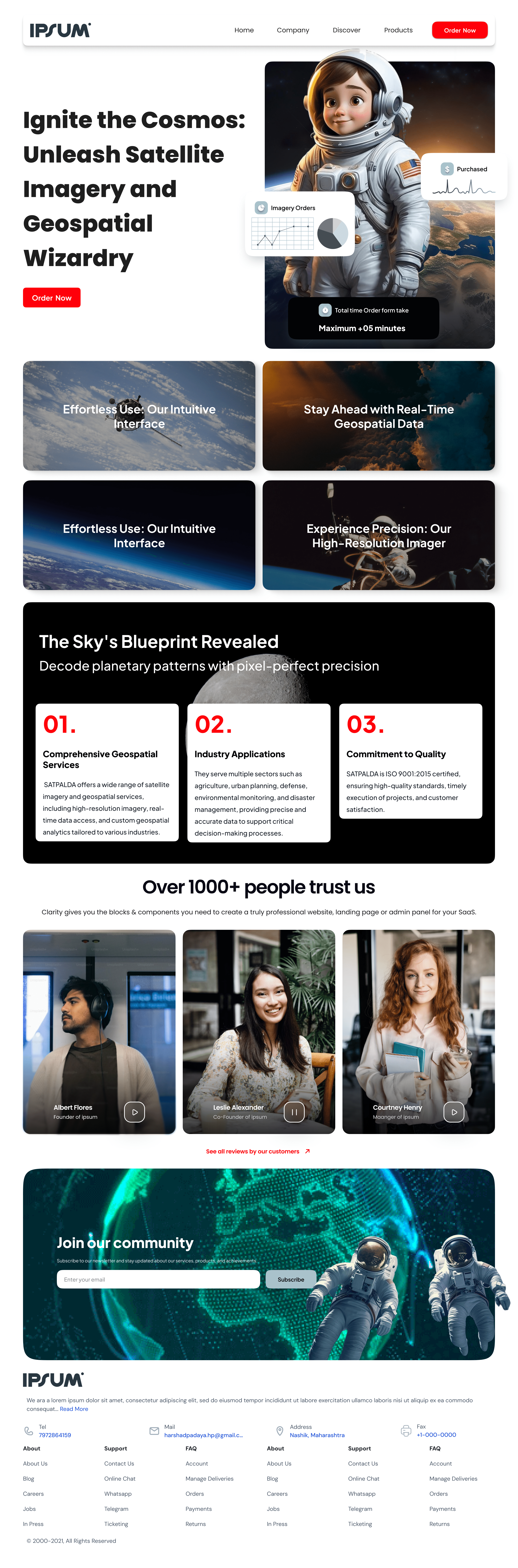
Satsale is a satellite imagery selling platform designed for both individuals and organizations to easily discover and purchase satellite data. The main challenge was to simplify a complex workflow—selecting an AOI, choosing resolution, operator, time range, and imagery type—into a clean, guided user experience. I designed a map-first interface where users can draw and save their required AOI using rectangle or polygon tools, then apply filters to refine imagery results. After submitting the request, the platform follows an admin verification process where requests are approved if imagery is available and clear, or rejected if the data cannot be provided. This design improves clarity, reduces friction, and creates a scalable system for future features like pricing, downloads, and order history.
Categories
Satellite Imagery Platform
GIS UI/UX Design
Date
Client